IN Minnesota & Dakota
---------------
Source: The Red River (, , American English: Red River of the North) is a North American river. Originating at the confluence of the River" class rivers between the U.S. states of Minnesota and North Dakota/ · Geography · Geology · Floods · See also ·
Source:-----------------------------
http://en.wikipedia.org/wiki/Lake_Traversesouthernmost body of water in the Hudson Bay watershed of North America. It lies along the border between the U.S. states of Minnesota and South Dakota. A low continental divide separates the land at the southern shore of Lake Traverse from the Little Minnesota River, which is part of the Mississippi River System and flows within a mile of the lake near the town of Browns Valley, Minnesota and Wheaton, Minnesota.
Prehistorically, the south end of Lake Traverse was the southern outlet of glacial Lake Agassiz across the Traverse Gap into Glacial River Warren; that river carved the valley now occupied by the present-day Minnesota River.
Lake Traverse is drained at its north end by the northward-flowing Bois de Sioux River, a tributary of the Red River of the North. A U.S. Army Corps of Engineers dam at the outflow regulates the lake's level. The Mustinka River flows into the lake just above the dam.
See also:http://en.wikipedia.org/wiki/U.S._Army_Corps_of_Engineers
We can hire our own TEXANS to DIG THE CANALES with tips from our United States Army Corps of Engineers
U.S. Army Corps of Engineers |
|
Active |
16 June 1775 – present |
Country |
|
Allegiance |
|
Branch |
|
Size |
36,500 civilian and military (approx. 2%) members[1] |
Garrison/HQ |
Washington, D.C. |
Motto |
Essayons (Let Us Try) |
Colors |
Scarlet and White[2] |
Website |
|
|
|
|
|
|
|
U.S. Army Corps of Engineers Dredge Tauracavor 3 in New York Harbor.
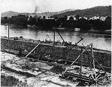
Mississippi River Improvement, 1890.
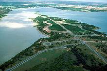
Proctor Lake, Texas, constructed by the Corps of Engineers to provide flood control, drinking water, and recreation.
The United States Army Corps of Engineers (USACE, is a U.S. federal agency under the Department of Defense and a major Army command made up of some 36,500 civilian and military personnel,[1] making it one of the world's largest public engineering, design, and construction management agency. Although generally associated with dams, canals and flood protection in the United States, USACE is involved in a wide range of public works throughout the world. The Corps of Engineers provides outdoor recreation opportunities to the public, and provides 24% of U.S. hydropower capacity.
The Corps' mission is "to provide vital public engineering services in peace and war to strengthen the nation's security, energize the economy, and reduce risks from disasters".[4]
Their most visible missions include:
- Planning, designing, building, and operating locks and dams. Other civil engineering projects include flood control, beach nourishment, and dredging for waterway navigation.
- Design and construction of flood protection systems through various federal mandates.
- Design and construction management of military facilities for the Army, Air Force, Army Reserve and Air Force Reserve and other Defense and Federal agencies.
- Environmental regulation and ecosystem restoration.
The Corps' vision is "having a great engineering force of highly disciplined people working with partners through disciplined thought and action to deliver innovative and sustainable solutions to the nation's engineering challenges".[4]
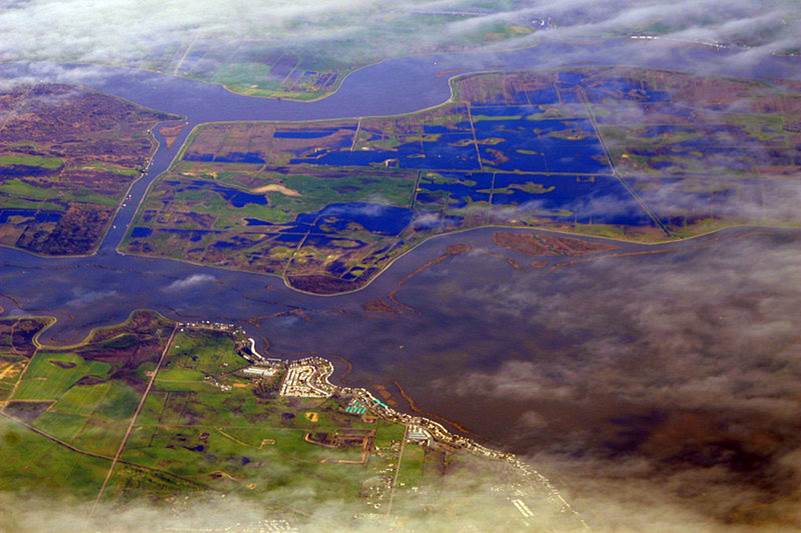
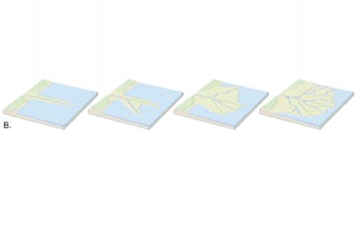
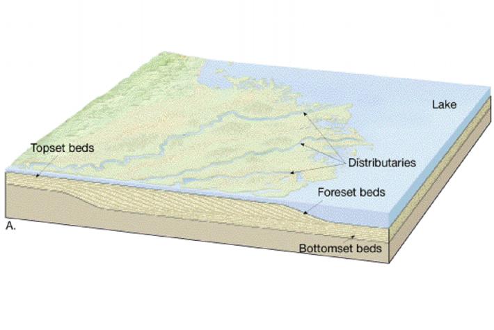
river delta is a landform that is formed at the mouth of a river, where the river flows into an ocean, sea, estuary, lake, or reservoir. Deltas are formed as the flow leaves ographic pattern of a river delta.
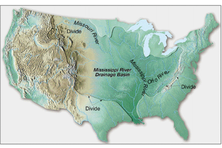
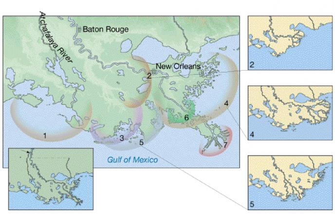
{{{{{{{{{ MISSISSSIPPI Coastal Erosion - The sinking Mississippi River Delta
http://atlanticrising.org/classroom/coastal-erosion.asp
The Mississippi river stretches for over 2,300 miles. It transports half a billion tonnes of sediment each year. The Mississippi, like many other river deltas around the world, is now under threat of sinking due to human impacts to the area. Damming and diverting has meant that much less sediment now reaches the delta. In addition the extraction of gas and groundwater is lowering the level of the land. This is causing the delta to sink much faster than the rate at which sea levels are rising (see diagram pack). As the river delta sinks, the area and the people that live there become more vulnerable to flooding, storm surges and hurricanes. The phenomenon is not unique to the Mississippi river delta.
___________________________________________-
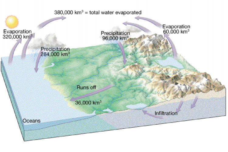
LETS LEARN ABOUT WATER AND HOW IT RUNS OFF AND HOW TO MAKE IT WORK FOR US
- Control floods & divert water to TEXAS..
HOW WOULD YOU BRING THIS WASTED DRAINAGE BASIN & DELTA WATER TO TEXAS?
NOW LETS LEARN ABOUT WATER & HOW IT GOES TO THE SEA.
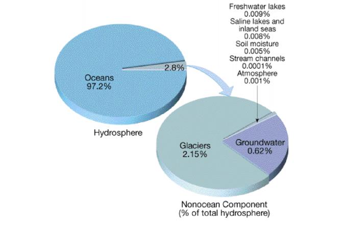
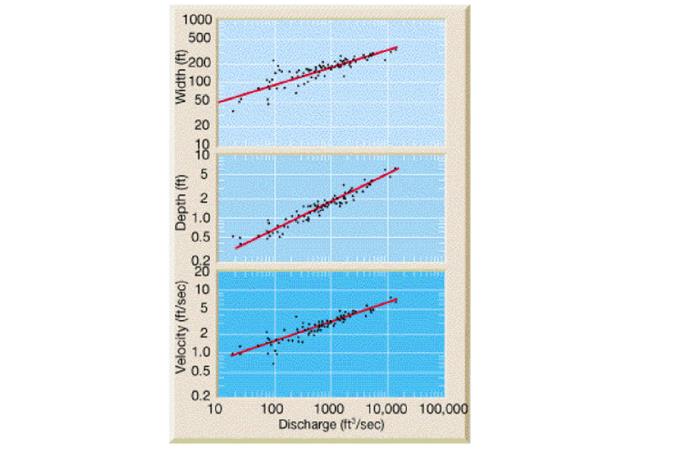
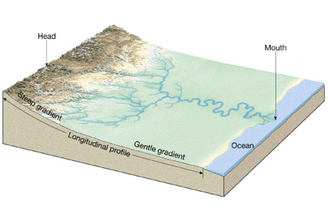
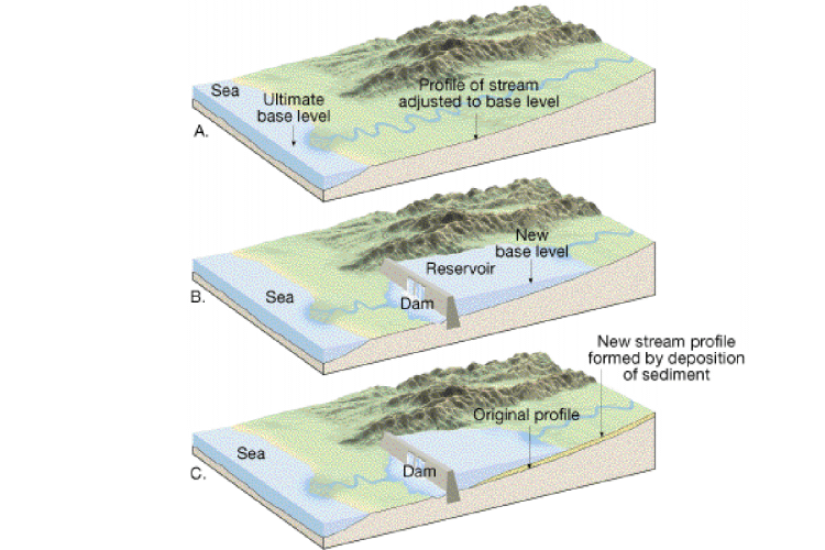
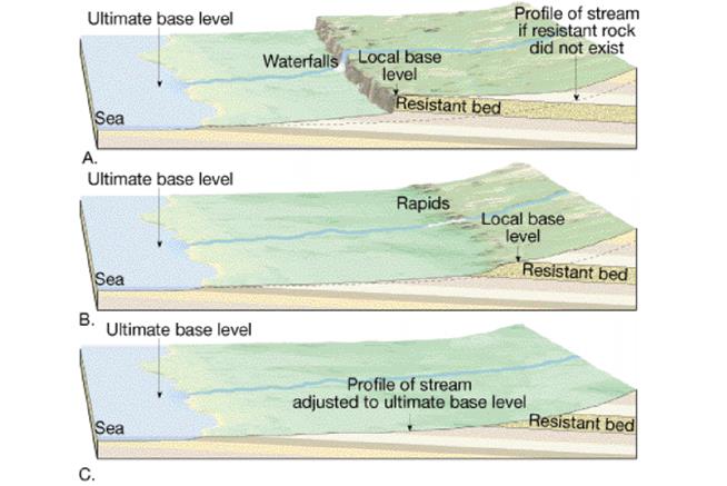
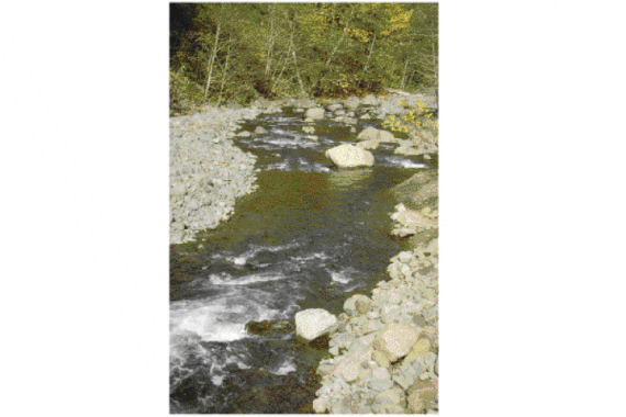
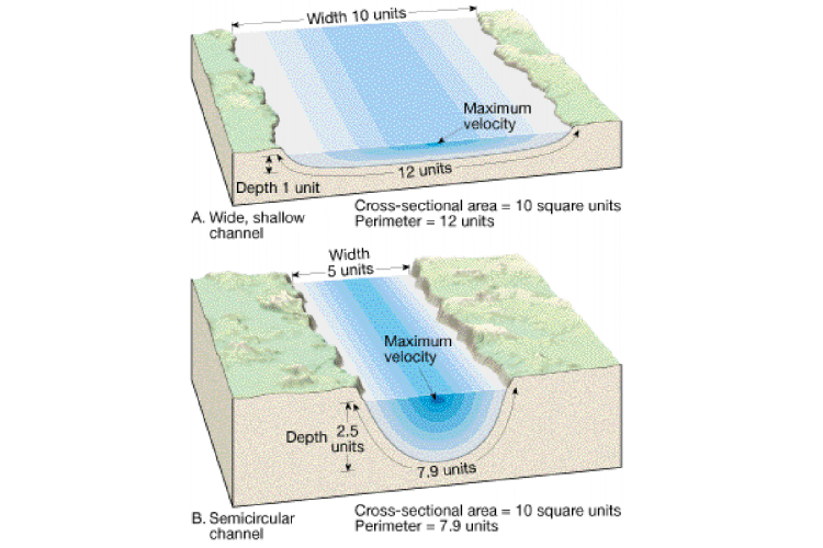
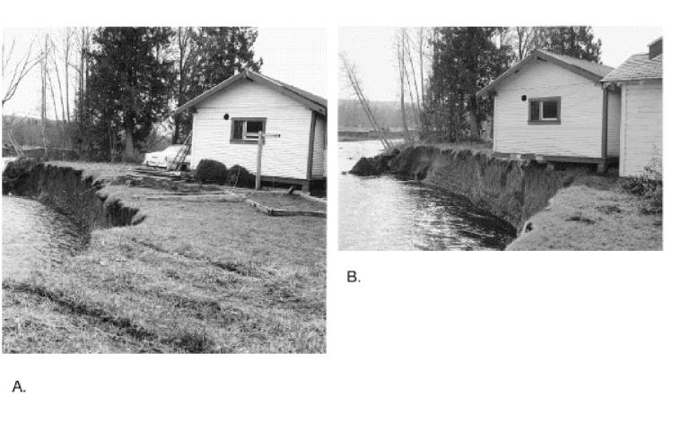
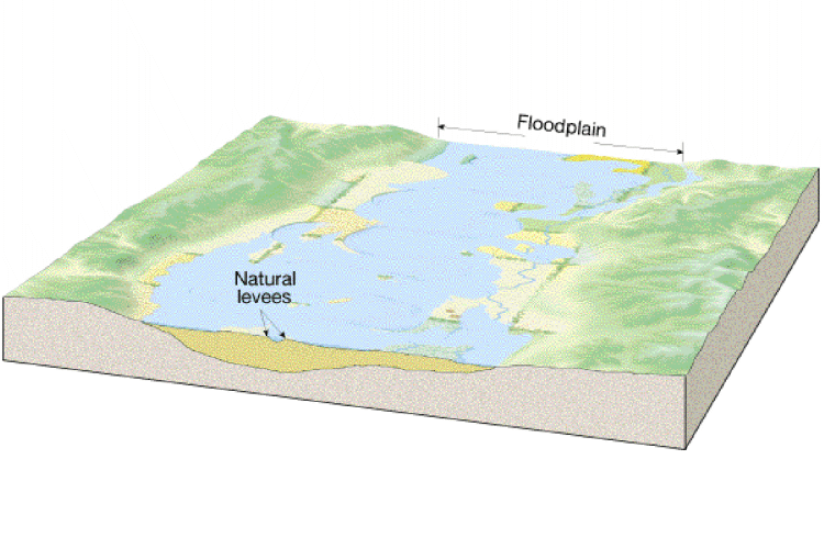
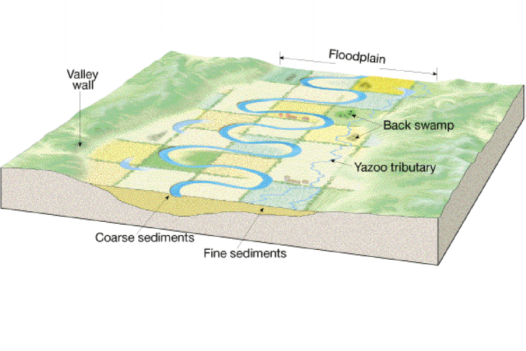
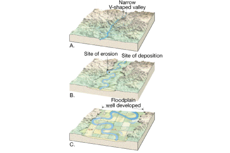
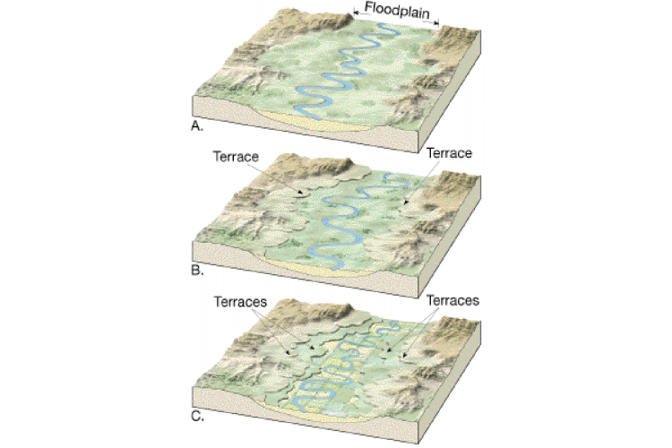
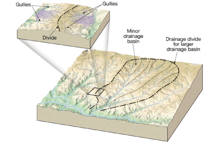
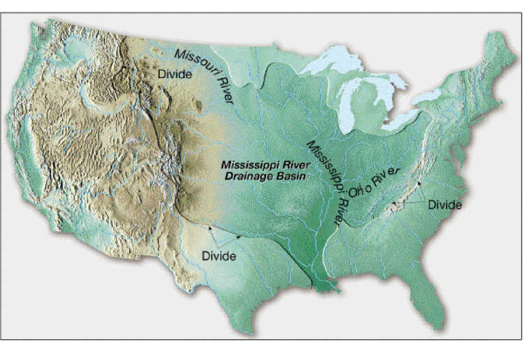
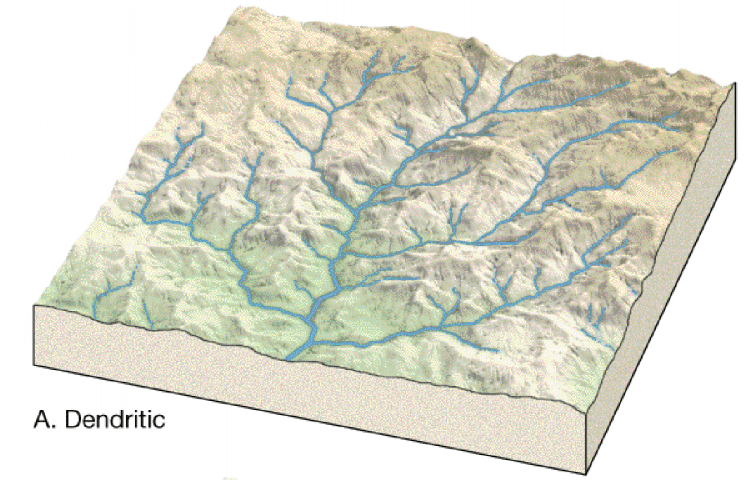
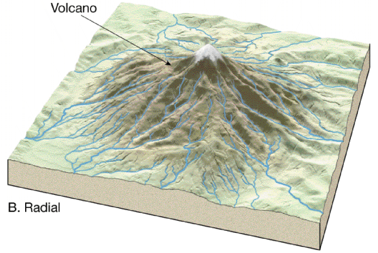
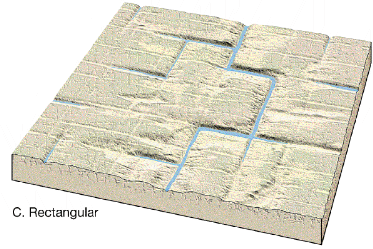
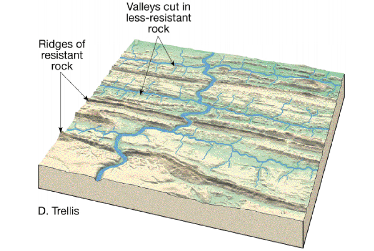
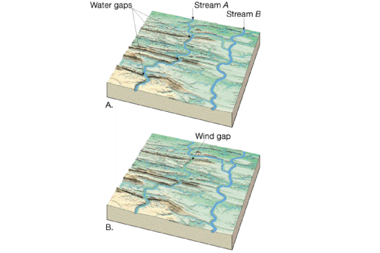
Landscape Evolution (Groundwater, Rivers, Glaciers, etc.)(Depending upon your printer, you may have to adjust your page and/or printer settings to make a print out of the following diagrams. These adjustments may include things like page orientation, page reduction (80% vs. 100%), color vs. grayscale, etc. If in doubt, do a print preview prior to printing!) I recommend either color or grayscale for these images.
River and Stream Systems - Diagrams
![]()
![]()
Back to The Geology 300 page |
Back to The Geology 301 page |
|
Back to the Geology 305 Page |
Back to the Announcements Page |
Back to My Home Page |
Back to the ARC Home Page |
Back to the Columbia College |
|
--------------------------------------------
IF YOU LOOK AT THESE MAPS.............YOU CAN SEE HOW THIS WATER CAN STILL GO TO THE SEA...........YET WHILE HELPING MANKIND.
http://viewer.nationalmap.gov/viewer/


